Cuba, the largest island in the Caribbean, is known for its vibrant culture, rich history, and stunning natural beauty. From its colorful colonial architecture and pristine beaches to its lively music and dance, Cuba offers a captivating experience for travelers. In this comprehensive guide, we’ll explore Cuba’s geography, delve into its fascinating history, showcase maps to help you navigate the island, and uncover intriguing facts about this iconic destination.
Introduction to Cuba
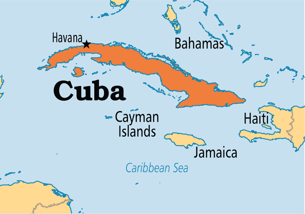
Cuba, officially known as the Republic of Cuba, is an island country located in the Caribbean Sea. With a population of over 11 million people, Cuba is the most populous island nation in the Caribbean and is renowned for its warm climate, friendly people, and iconic landmarks.
Fun Fact
Cuba is home to the world’s finest collection of vintage American cars, which have become a symbol of the country’s unique charm and resilience.
Geography of Cuba
Cuba’s geography is characterized by lush tropical forests, rolling hills, and sandy beaches. The island is approximately 1,250 kilometers (780 miles) long and varies in width from 32 to 210 kilometers (20 to 130 miles). Cuba is also home to several mountain ranges, including the Sierra Maestra and the Sierra del Rosario.
Fun Fact
The Ciénaga de Zapata (Zapata Swamp) in Cuba is one of the largest wetlands in the Caribbean and is renowned for its biodiversity, including endemic bird species and rare crocodiles.

- Kenya Maps & Facts - June 24, 2024
- West Virginia Maps & Facts - June 24, 2024
- Maps Of Saudi Arabia - June 20, 2024